Montenegro – I Think I Love You
Posted by TravellingStrom on May 19, 2012
Mayan Prophecy Countdown
[gigya src=”http://www.clocklink.com/clocks/9001e-green.swf” flashvars=”TimeZone=GMT1000&Target=2012,12,21,12,00,59&Title=The End is Nigh” width=”288″ height=”24″ wmode=”transparent” ]
Friday May 18
I have been in contact via text with my cousin Anthony, he is in Bosnia visiting a family and will be heading down here to ride with me for a while. I decided to stay at this hotel in Podgorica, as it was central, had a good internet connection and I could use it as a base for some rides. As Anthony would be a few days away, I decided to chase a cache up near the Bosnian border to start with, then another near this town but the opposite direction. I had a late start as I was going through all the video footage I had kept to either delete it, or save portions, and to do a post for you out there. The ride was only 120km and it was around 11.30 that I left and headed north in cool but clear weather, real pleasure to ride in 🙂 I would like to do some maps for you, but they are very time consuming, worse than the videos, so I won’t, but anyway, I went through this valley system, great views and before long I was heading up the mountains where it got a colder, until I arrived at a lake system, that looked very cold, so at least I was dry.


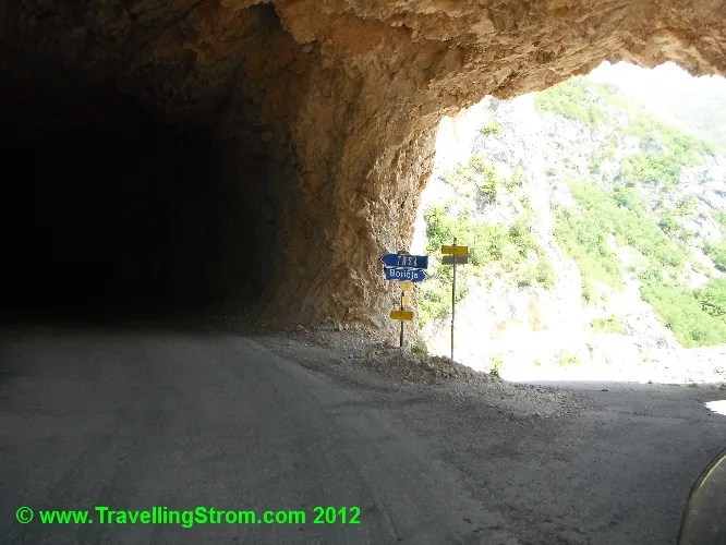
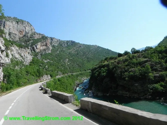
Well, it was amazing to ride through this section, I had to pull up for some road goats, very fluffy things too, quite neat and clean 🙂 But as amazing as this seemed at the time, it was nothing to what was to come 🙂 I got a bit confused around here because my GPS was saying, turn right, but there is a bloody cliff there!!! After ignoring it and going past, I eventually came back and turned into the cliff!!! Yes, it was a dark tunnel that performed a Uturn inside the mountain, how cool and over the next ten minutes I did this trick many times to get to the top. I tried to post a video of the ride but it failed, it was very big anyway, so instead I stopped near the top and used the helmet cam to give you view of the scenery 🙂


As you can see it was a fabulous place, and I reckon they need to install a cache right there where I stopped, what a view 🙂 I am still smiling 🙂 Anyway, I still have more hill to climb, so onwards to the top and now I am getting quite cold, in fact I am above the snow line riding very narrow roads, all sealed though, so no big issues except for oncoming cars. I eventually get to the top and arrive at a small town called TRSA, which seems to be a camping village. But, the reason I was here was to find a cache, which was near a statue, not a hard thing to miss in this little village, I had to be careful because of course I attracted some attention, but yippee, I found it, great day so far 🙂


The next thing to do was get warm, so I went and had some lamb soup(minus the actual lamb) with fresh baked bread, a great fill me up and the nice young lady was a bonus, and posed for a photo, next to the sticker I placed on the wall. My idea as I tried to explain was that it is a great ride, and it may start a trend with other adventure travelers, so they will get more tourism, their only economy, I am not sure she fully understood, but it worked for me 🙂

The only bummer for the day was that she told me the road was closed between here and the next town to the east, I had planned on making it a loop ride. The pass has not been cleared yet from winter snow, so I had no choice but to go back the way I came, not a bad 2nd choice eh 🙂 So, I went back out into the cold and headed back down the mountain. I thought I would throw this photo in here as I see the same signs everywhere.

Just a cow sign, but they have square udders, I am not sure if they are censored, or special cows that produce the milk that goes in them square containers? I’ll leave that for you to think about! So, after a great couple of hours doing all those roads and tunnels again, I get back through Podgorica and head towards the coast town of Bar. Down here is a small lake system and an old Turkish strong post which is the location of the next cache I wanted to find. As it turns out I cannot park next to it and have to hike it along the rail lines, which is frequently used, but I get there late afternoon, and find the cache 🙂


Then the day finished with a couple of beers and a nice feed, just the usual 🙂
————————————————————————-
Saturday May 19
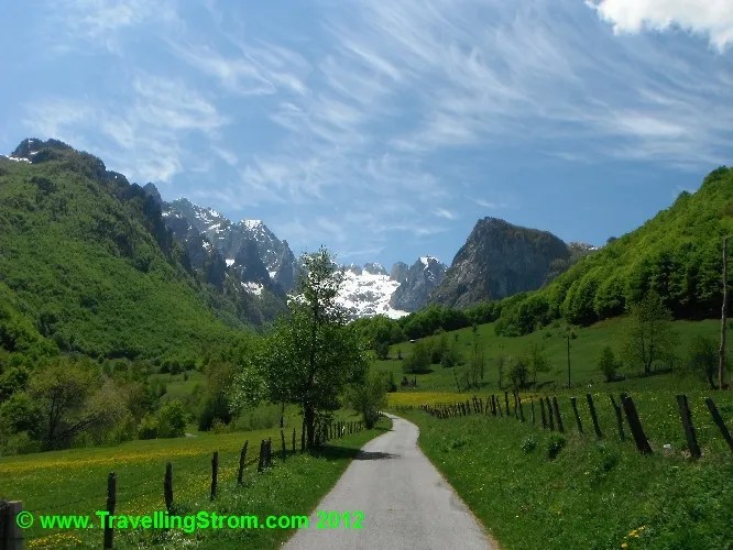
With Anthony due to arrive this afternoon, I had planned a day ride to the east border area of Montenegro, the goal was to find the Lost Rock, a cache that had been placed but never found(although it is located here apparently, just copy/paste this in google maps N 42° 28.884 E 019° 49.530). I knew it involved some hiking, but I had given myself plenty of time, or so I thought! First things first, I had noticed my pannier racks were a bit loose and found one loose bolt and one missing screw? So, I got that sorted out before anything, and then headed up north and east through this valley, the roads were terrific and fast sweepers, although the speed limit of 50 made a mockery of it, not that I nor others paid much attention to that 🙂 This road climbed very slowly as it followed the river and eventually I had to stop and add my warm jacket and gloves and the tunnels made it interesting as well but there were some nice views from up here 🙂


After I turned east I had some very narrow forested roads and hairpins to play with, this slowed me down somewhat! I had planned on about 3 hours to reach the target and the distance was 146km, but that was OK, I was still within my time frame, and still had a 3 hour hiking limit as well. I kept noticing these beehive things in everyones yard, it had me stumped for ages, then as I looked closely I realised it was a hay stack with a covering 🙂 There were many small villages throughout this valley system and that meant the speed was kept slow, quite a few times cars would come past without slowing down, but once the cars were out of the way I found the most fabulous (suck eggs Roz) view and had to stop for a photo, one of my best I reckon 🙂


But eventually I get to a dirt and gravel turnoff which was a bit rough and so was the ride down to the river and here it was that I was stumped! I am not fond of water crossings as I have bugger all clearance, so I got off and walked the creek, it was COLD and about mid calf but had a slippery muddy bottom. I decided to give it a miss as a car went past, nearly got bogged on the other side and came back again. 🙁 A shame really, the cache was still 7km up that valley somewhere, but it can stay lost today, I did not time budget for a 14km round trip hike!


Never mind, the views were spectacular and at least I got to see them 🙂 So, after a multi point turn on the slippery track, I headed out to another cache in the same general area, this one is called the Eye of Skakavica,(N 42° 30.724 E 019° 50.094) so off I go, back the way I came until a small village then take a different turn. I thought the last dirt road was bad, this one was overgrown, what am I getting myself into?


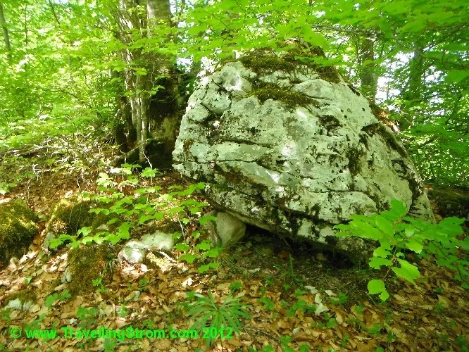
I got to a point where the road ran out and was covered in massive rocks, I would need a KTM from here in in, so it was shanks pony from now on, only 1km to go 🙂 The walk up the old track and through the scrub was fun, sort of and took about half an hour, but I eventually arrived at the cache location, after disturbing a small snake, I think it was a snake, not vicious or anything, so it may have been a slow worm? Watch the video and tell me what it is?


Eye of Skakavica Karstic source near Gusinje, in close neighbourhood of Vusanje, in Rupojana valley. Sources at height of 1.000 meters above sea level, has circular shape and cone shape of bottom, with deep opening on it, from which the water sources. On the north and south side there is a 3-5m high limestone cliff.
Eye is one of strongest sources in Prokletije region. Its lenght is 30m and width 25m. Towards the centre the depth increases and reaches 8m. Bottom sources of crystal clear wate is possible to see in the point of the maximal depth.
During hot summer, especially in August, is the source rather weak. In spring months the water comes from south and west and connect Eye in one creek.
The water of Eye is very cold due to melting of the Prokletije glaciers, which causes temperatures of 5 centigrades, deeper 4,3 centigrades.
Swimming is forbodden in this watersource of Vusanje. Despite this, the water and surrounding is polluted by the visitors.
Skakavica is the name of the sourcing creek, which it got from the grasshopper.
Lower down the creek towards the village Vusanje the creek falls under the ground by the Grulja waterfall.
So, the most obvious place for me to find this cache was a nice rock with a space under it, but I searched high and low for an hour amongst ALL the rocks in a 30m radius and found nothing! The cache hint said in the stone from above which is a translation that I took to mean, ‘amongst the rocks above the lake’, but I also looked in the rocks as well, nothing found, bummer, but it was a nice relaxing place to have lunch 🙂


After that as it was now gone 2.30 I headed back and once again had to ford an icy cold creek, but the spot I chose was a tad deeper than I thought and filled my boots up, yuck!! Once I got my self back to the bike I rested once again after draining all the water out and wringing the socks as well 🙂


I headed back now as I was expecting to meet my cousin but on the way stopped and had a chat with three German beemer riders I spotted, they were riding down into Albania, so I gave them fair warning, safe travels chaps 🙂

Not much else to say, the ride home was a delight, fast and smooth roads, although at one point when I passed a line of cars(doing the speed limit of 50???) I saw a copper pull one of the cars over, well, it had to have been, he would not be trying to pull me over would he? 😉 😳 But I got back OK with no light systems in my mirror and had a chance to dry out my wet feet, a few beers and a nice chook and chips, Montenegro style 🙂


I had been sent a text from Ant, he was still near Sarejevo around 4.30 and would be a tad late, well in fact he arrived around 9.30pm, well met cousin, I think it is our first meeting ever, not real sure, but even though the bar closed at 10, we managed to wangle drinks until about 1am or so getting to know each other, as we would be riding together for a while now 🙂
Cheers from Montenegro
TravellingStrom

brisbane2bristol said
wow wow,what a great place,will put this on are list for next year,that camera is taking some great pics as well,i gave caching away a while ago after doing 1100,but you have just reminded me why i was into it,it takes you to some great places
cheers clive
TravellingStrom said
The camera is great so far and caching is taking me places most people never go
ziggy said
Thanks for al the great photos and story lines. You are hopefully going to write a book someday, eh..?
Nice looking lady friend there Asif. I hope you got her phone number. LOL
Take care and keep on truckin’…or I suppose in this case…bikin’.
TravellingStrom said
Thanks ziggy, not sure on a book, too many out there and not enough market, but we shall see
Cheers
Asif
Preload said
Your really enjoying this that’s for sure. The views look awesome and the pics of them are perfect. Maybe Suzuki should sponsor you with a new V Strom next year 😉
TravellingStrom said
Hey that would be fab but I doubt they would do that 🙂
2wheels said
Wow, add Montenegro to the list!
TravellingStrom said
Montenegro is the pick of the Baltic states