I had a pretty good sleep, it even got a bit too warm at times, but you cannot have everything 🙂 I packed up and was on the road by 8.30am with not a big distance to cover, maybe! Here is a view of the pub from behind, check out the car on the roof!

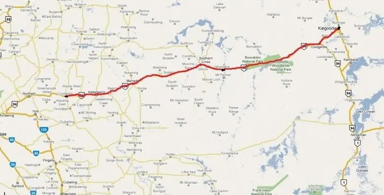
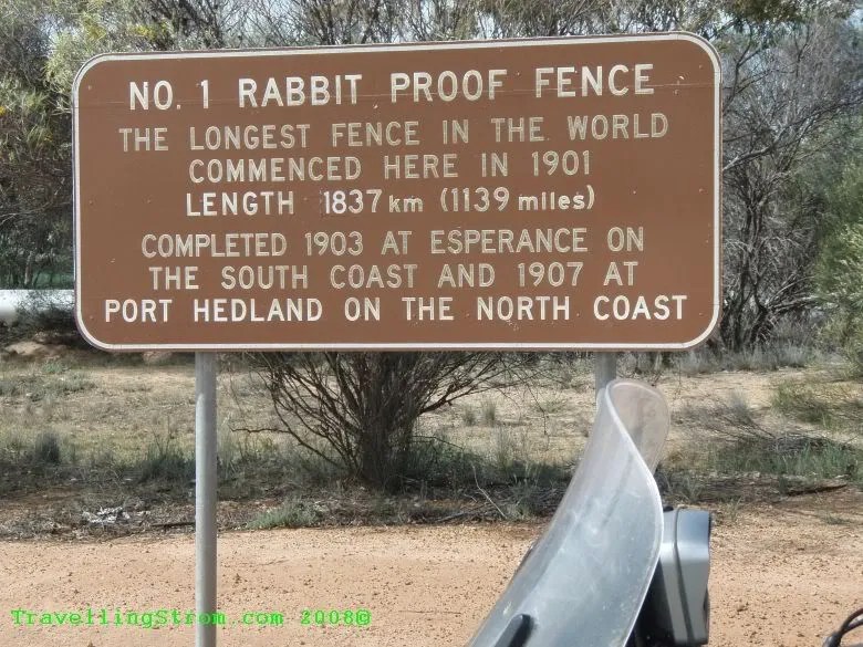
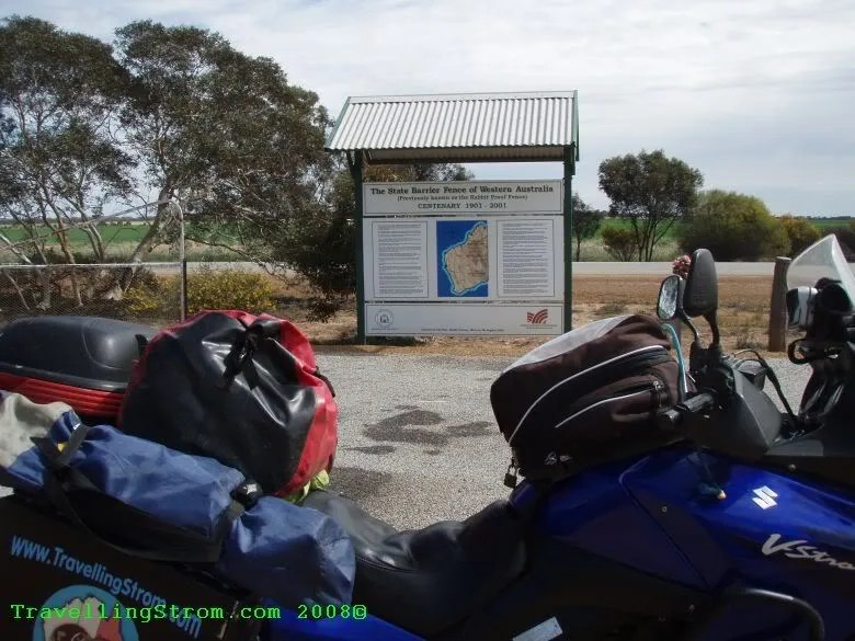
The wind was the same as yesterday from the east so I had a headwind for a lot of it. When I eventually got to Merredin I realised that I would have been riding in the dark yesterday if I had tried to make it, but they did have more choices in accommodation. I had been thinking while riding about which way to go here because of the long way around to get to Hyden or the dirt short cut. In the end I decided to go to Kalgoorlie as I needed to do washing and I also could find out the road conditions first. Just north of Merredin was a small town called Burracoppin which does not get a mention on googlemaps. It is the starting place for the longest fence in the world called the Rabbit Proof Fence. It was built to stop the rabbits coming in from the east. Here are a couple of photos of some info supplied at the rest stop.


I continued west and eventually came to the service station just after Southern Cross called Yellowdine. Between these two was the track south to Hyden and Wave Rock. I asked a couple of truckies but they were not sure on the road surface, they advised to go and ask the cops in Southern Cross. As I was leaving I met a miner and he had just driven down that road, he said it had been recently graded and was good until 60km from Hyden when it turns to bitumen. Decision made, I will do the road tomorrow on the way back from Kalgoorlie 🙂
All along the road out west I was following this pipeline, it was about 1m in diameter and there were all these turnoffs to Pump Station number whatever. I assumed it was pumping water to the goldfields but did not really know, but I would find out later.


I eventually got to Kalgoorlie just after lunch and picked up same info at the visitors centre then did my washing, in this breeze and the nice warm sunny day it would not take long to dry. I found out about the pipeline as well, it was proposed in 1895 and finished in 1903, it runs for 565km from Mundaring Wier to Kalgoorlie. Mundering is on the map above, if you continued the red line west through Northam to the edge of the map, that is where the pipeline starts, an amazing feat for that day and age!
The caravan park had internet but it was a rip off, they wanted $12 for a full day but only 10M limit, not worth it. I went and found a cafe in town, just across from the visitors centre for $6/hr and no limit. It was very fast so I managed to update 4 days worth and other stuff very quickly. I had a look around town, but it all seems to be about heritage trails and a lot of 4WD tracks to get anywhere. I listened to the weather report, they said rain west and south, so it may be wise to stay out here until Friday anyway. After dinner and a bit of TV, I was off to bed.
Day – 448km
Trip – 12,176km
top of page