Day 150 – 7th May 09
Thursday – Grand Canyon, Arizona
Mules, snakes alive and oh a deer, a female deer ? was the order of the day, apart from blisters and other aches and pains, but it ended with beer and a swagmans TV
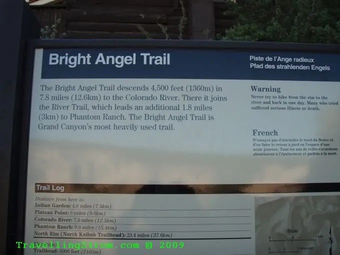
As I had had an early night, it meant I woke up early, so that was fine I had a canyon walk this morning. Up and at em, a quick cuppa and some breakfast, another danish pastry, I think I may be putting on weight, lol. Then down to the bus stop and off to the Angel Bright Trail head, that is it ringed in red, the little walking man thing.

This is where they corral the mules which are used to take people and goods down into the canyon.

It is now 7.40am and off I go, down the trail, at the first bend are all the customary warning signs, and no doubt needed as well.


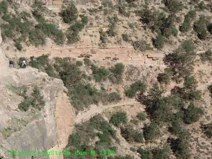
Then through a small tunnel and onto the main trail where you can see a mule train already on their way down and there is another group above me


A squirrel going about his business 🙂

Downwards I continue, with an occasional glance back where I had come from.


I saw some Condors, typical, I go down and they are up, and the photo I took is terrible, maybe next time.

This little guy was not scared of me at all, but he could hear that mule train coming down and they were getting closer.


I finally picked a spot so they could go past, humans give way to mules on this trail, but they leave a very dusty trail and of course the dung is on the nose a bit.


So, after 45 minutes travel downhill I had reached the first rest point, which despite reports to the contrary, it did have drinking water. Oh well, carting 3 litres of water downhill is easy, especially as you drink it as you go, which means less to carry for the upward journey.

That group had been down to Indian Springs and camped over and were on the final mile and a half uphill. I decided to make this my turn around point, despite the fact I had extra water supplies. I am a biker, not a hiker thank you!
Of course, as the signs say, what goes down, must come back up, so after a 15minute break I started back up. I was only 300 meters vertically down, but that equates to 2.4km on the trail. It looked a bit steep mind you 🙂

Yep, getting closer but I gave myself 5 minutes break every 15 or whenever there was shade. The trail was sometimes by now in full sunlight and it was very hot, I do not think I can imagine doing this in summer, except maybe at night.


Some of the people were fully set up for hiking uphill with all the sticks and things, but I am sure they have done hiking before, unlike me.


I remember that small tunnel, yep the trail head is just a few hundred meters the other side. Phew, made it 🙂


I actually did quite good, pushed it all the way, kept the pace on as I needed the exercise and did the return in 50 minutes, faster than I expected, but it was head down bum up type effort. Well, I had planned an hour down, 2 hours back, it was still only 9.30am, what to do? I could feel a few tight spots on my feet where blisters could be forming, but I had heaps of water, I was not puffed so I decided to go do the Green route and look at the views over on the east side of the rim. This involved some shuttle bus shuffling and eventually I got to South Kaibib Trail head an hour later.

This place also had the warning signs, apparently 250 hikers each year call 911 because they have over exerted themselves, and most are fit young men like myself. 😉

The reason for building this trail is interesting.


I do not intend hiking 9 miles downhill just to get a photo of the suspension bridge, if the mules were cheaper and I did not have to book a year in advance, well, that is another story. So, if you want to see it, on ya bike 🙂
The trail looked ok to start, but soon went very steeply downwards, so I took a few photos and backed off.


Now, I had seen these white fluffy web like affairs down in Joshua Tree NP and mentioned they reminded me of the processionary caterpillars we had in Aus, that I saw out near Ayres Rock, well here was another one and there was even a caterpillar in it, so maybe they are related, it is that red looking thing in the middle?

This place is also the return journey for the overnight mule rides, so there is another corral for them up here.

OK, on the bus and get to Yaki Point, the eastern most part of the park as it is. I had 15 minutes until the next bus, so I wandered around a bit.


I said to the guy who offered to take this picture, do not ask me to step back thank you 🙂

Still waiting for the bus 🙂


The bus arrives and drops us at Pipe Creek Vista, and I guess that is Pipe Creek down there and the view to the northern rim is excellent.


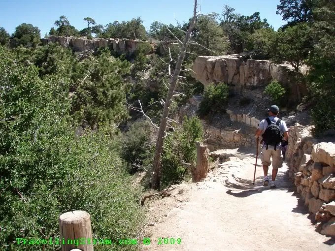
The walk from here to Mather Point was only about 2km, and as it was still only 11am, I decided to give it a whirl, so off I head. It is a brand new bit of tarmac and winds through a bit of country with some nice little tracks to the rim. It was on my first little foray down a small track that I nearly trod on old sammy snake!!!


If anyone can identify the snake from the markings, please let me know. I just stopped dead and it did not even notice me but kept on going, it was about 3ft long and definitely had no rattle.
A few shots from the rim.


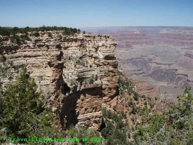
In this shot you can see the trail down the ridge back, unlike the one I went down which followed the canyon wall, this one goes all the way down the ridges, it makes for better views, but a lot steeper of course.
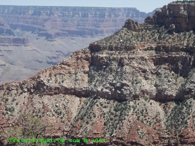
A few more views from the trail as I go.


Right down there in the middle is Phantom Ranch, one of the destination points in the canyon itself, you can see the green bits and a few white specks which are buildings.

I kept on walking and just after this I see some people on the path coming towards me, one of them is waving his arms madly but saying nothing, I think WTF, I don’t know these people do I? But, then he points to my right and there is a Deer, right on the rim edge and not happy about it, so I stopped and it ducked across in front of me to get to some grass there.

That cliff over there is my destination, and hopefully the end, cos my feet were hurting now, the blisters were starting to form up and were creating pressure points.
I finally got there, and saw these signs advising people not to throw coins over the edge as it can kill Condors, well, for some reason there is this rock just on the other side of the safety fence which is covered in coins, I wonder why the rangers do not clean this up?


I was had it by now, only the legs and feet mind you, but I had a plan 🙂 First up, get the next shuttle bus back to my bike, which I did, then back to camp to pick up my wallet which I left there, silly me. On the way in I saw a heap of firewood at an empty camp site, so I walked back and grabbed it all 🙂 That made the plan a whole lot easier.
Next stop was back into the small town of Tusayan where the air conditioned visitor centre was, and of course free WiFi. While charging the lap top I had some lunch and posted a blog, basically spent about 3 hours here away from the heat of the day as there was no shade at the camp site until late afternoon.
Then the next part of the plan, I went back to the camp about 5 ish, cleared out one of the panniers, had a nice shower which cost 2 bucks, but after 3 days was worth it and bought some beer and ice, lucky me I had my Happy Trails Crash Pannier Esky 🙂

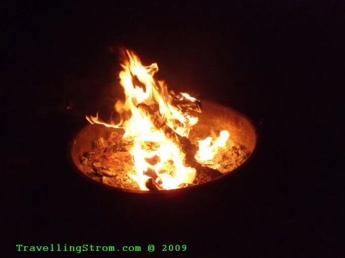
But I had the makings of a good fire as well, so all is good, cold beer on a cold night is no fun without a fire.

Then I started to look at the road map of America, this is when I realised I had a lot of ground to cover, which meant I had better start covering some ground soon, but over a beer this is an easy comment to make 🙂

I fired up the fire just to make sure I could and to get a start before dark.

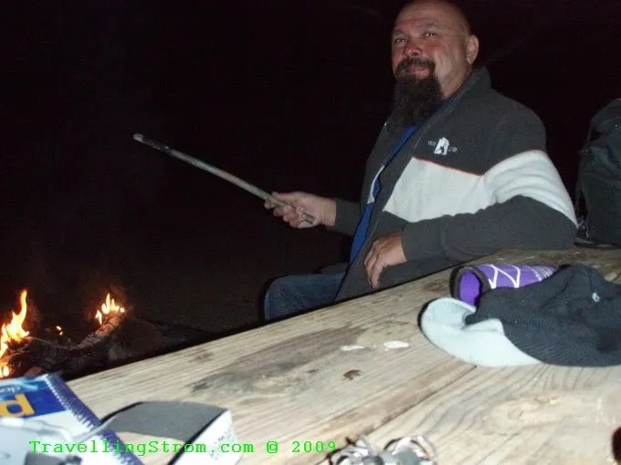
After that I had a few more beers, wrote most of this and then watched some TV, which you can see in the background.

I changed channels a few times with the remote I had also found with the wood and basically had a nice easy night, tomorrow I would be on the road, but I still had no real idea which way I would go, too many choices!

So, all in all a long day but very enjoyable.
Day – 17 miles and 27 km
Trip – 6,497 miles and 10,456 km
Cheers
TravellingStrom
Go to top of page