Day 167 – 24th May 09
Posted by TravellingStrom on May 24, 2009
Sunday – Starkville, Mississippi
Another dry old night, but a wet old day
Well, after looking out the door this morning I was really unimpressed by what I saw and I had to put the hubs in just to get out the driveway 😦

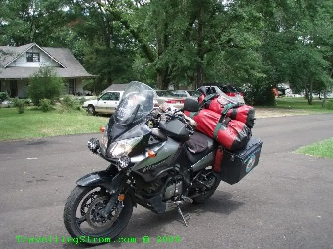
But, although I dithered around, it did not seem to be clearing up and the weather channel confirmed it across the whole region. There was no way I would spend another night here, that is for sure! Oh well, into the breach and all that, so I packed up, got all the wets on and off I go south towards Louisiana.


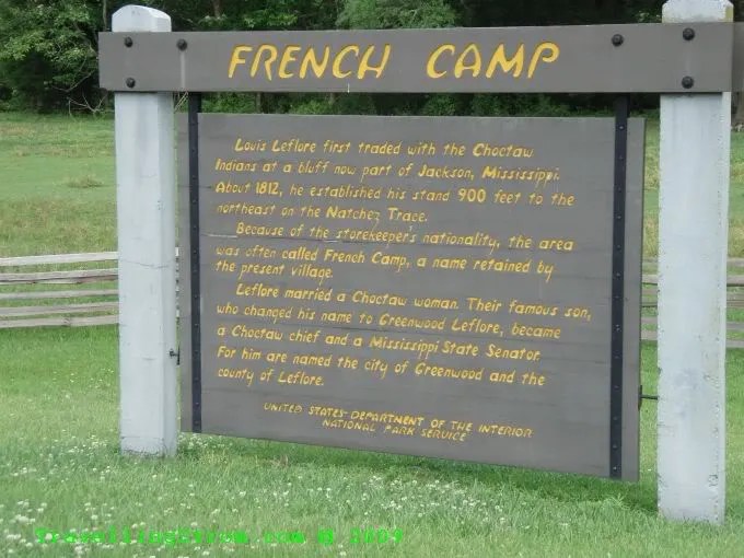
If you look at the map closely, you will see I have drawn in a violet coloured line, this goes from the city of Natchez to Jackson, in Tennessee. That was the road I was aiming for, more on that later.
I got my first sighting of the mighty Mississippi River down near Lake Providence, it was quite wide as you would expect, probably about twice the width of the Fitzroy River back home, but I am sure it will get wider.

Another state for my collection, I have to collect something as there are no wildlife signs in this country, except deer and I have most of them.

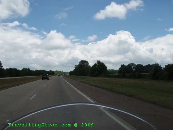
It was getting quite blowy down here, the rain had turned into patchy drizzle, annoying but bearable. The flags were out and so was the lean again, but I guess the bats and the night life would like the wind 🙂


You see some funny machinery on the town roads around here.

I fuelled up at Tallulah and because I did not know where I would be next, having no map of Louisiana, I decided to get a snack from a Wendy’s, that was when I noticed all the Kangaroos over the road, shame I had already fuelled up, they remind me of the Matilda servos back home 🙂

I start to head east with a bit of sun breaking through until about half an hour later I cross the very active Mississippi River and into Mississippi the state and the town of Vicksburg 🙂


First place over the bridge is a visitor’s centre where I scored a map 🙂 Now, check this map out you Arkansas-eans, this is how it should be, the county boundaries are still visible, but not in your face and the roads are usefully coloured with major, minor and minor minor roads. Although, I did end up on some roads that were not shown on this scale map 🙂 In all the traffic around this area I never did manage to get a Welcome to Mississippi sign so I would try and get one going out of the state. If you find Vicksburg on the map, then follow the 27 south of it towards Utica, the road crosses that green line, that is the Natchez Trace Parkway and the beginning of the days goal. All I had to do was get on that and head north, I was then set for days, it looks easy head south and turn left to go east 🙂

But first, I had to get out of this town and onto the 27, a few photos of the old and new bridges and a steam paddle boat at dock from the lookout then the scenic ride through town to get out.


Now, as I travelled down this road I was looking for a sign that pointed to this trace, but I had no idea what it was or what it would be like. I had been told by a chap on the forums called Tank about this trace and all I knew it was scenic etc. So, eventually I came across a sign that pointed to my right, which is west, but what I wanted was a road to the left and east, so I kept on going and got to highway 18, so I had missed it totally, how, I should have crossed it somehow?

So, I decided to go find a small town up towards Jackson way and ask someone, so I went straight ahead though the intersection via some very tight narrow laneways to a small town called Learned, now, they should know something 🙂 I ended up asking the chap in orange behind the bush on the right about the trace.

He told me how to get on it but he said it was closed near here and I may get fined, so I took the next bit of advice which was to head the fast way to Ridgeland, just north of Jackson and start on it there. All this took a bit of time of course, but eventually I got to a place where the signage and direction matched what I wanted. 🙂


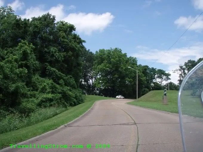
I still have no idea what this is about, but there were green trees, not a lot of traffic and a reservoir for water sports and then more green trees.


There some small places to pull over and read the info and look at the scenery as well. I liked the look of this place, I want one in my back yard, it would be so cool on a moonlight night 🙂


They even named a road after me old mate Reddog back at home 🙂

The downside of this place was the 50mph speed limit, which once again not many people seemed to be worried about and although the signs did say radar enforced, I saw no cops at all. The trees intermixed with some open grassland areas which allowed some sun in, when it was out, but you can see the road is drying up which is a good sign.

Cole Creek was another small trail outlining this particular creek system, but due to water levels the track was covered. I only noticed it was a trail because I saw the interpretive signboard (red arrow) in the water on the way to the other boardwalk over that way a bit.


Apparently this chap was very famous around here, not a bad result I guess after reading it.
Oh look, a Harley in the back of a ute, how unusual, not!

I finally find a place that describes what the whole place is about, not a bad effort for them days I reckon and a trace of the trace is still there in parts.


Well, it was getting on for 5pm and I judged that there was no way my fuel would last me to Tupelo, which was another 80 miles up the trace, so I decided to call it quits and find a room in Clarksville, about 20 mile to the east. I did so after stopping here about 10 mile away because of a storm cell, by the time I got all my wets on, it had gone but I was rewarded with a nice rainbow instead of a shower 🙂

After the last two grotty motels, I decided on a clean one and picked a Days Inn, he gave me a bit of a discount as well and I knew I could get a day’s worth of tucker from the breakfast bar, worth another $10, but still pushing the budget 🙂

He told me there were two bars in the area, both at diners, so I trundled down to the first one he recommended called Chillies, about 100 meters away, if that.

No chance of a beer here sorry, it is Sunday, no alcohol sales WTF, what stupid rule is that? Oh well, down to the next one called a Ruby Tuesday on the other side of the road just past the Piggly Wiggly, don’t you just love the names and I am sure the words Ruby Tuesday are part of the lyrics to a song I know, I just have to think who sings it now as it will have a different meaning 🙂

No go, same story, bars closed on a Sunday, and the closest beer is about 20 mile away, oh well, an AFD is good occasionally 🙂 They had elections coming up soon, I have seen the billboards advertising, so I asked the manager to vote for someone who can change the laws. He said it is very hard, it is only recently that local shops could sell cold beer, because the owner of the local ice company wanted people to buy his ice and was very powerful, but he lost that bit of power finally.
So, I had a quiet evening watching the soggy bottom boys in a movie on TV called Oh Brother Where Art Thou. I have seen it before, but now I was in the area it related to and the music really fitted in 🙂
Rain is forecast again for tomorrow and I still had a bit of the trace to cover, about 300 mile or so, but that’s life.
Day – 341 miles and 549 km
Trip – 10,738 miles and 17,281 km
Cheers
TravellingStrom
Go to top of page

Leave a comment